By Norma Franklin
The Zinman Institute of Archaeology
University of Haifa
By Jennie R. Ebeling
Associate Professor of Archaeology
University of Evansville
September 2015
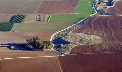
center left) and Area S from the west.
Todd Bolen photo.
For four weeks in May-June 2015, the Jezreel Expedition team returned to Tel ‘Ein Jezreel, the lower tel located just north of Tel Jezreel and above the Spring of Jezreel (Figure 1), for a third season of excavation. Located in the fertile Jezreel Valley approximately midway between Megiddo and Bet Shean, “greater Jezreel” was occupied from late prehistory through modern times (http://www.bibleinterp.arizona.edu/articles/ebe368017). The Jezreel Expedition is directed by Jennie Ebeling and Norma Franklin and sponsored by the University of Evansville and the University of Haifa. In 2015, the Jezreel Consortium includes Chapman University, Moravian Theological Seminary, University of Arizona, Vanderbilt University, Villanova University, and Wesley Theological Seminary; as in previous years, most senior staff and team members were affiliated with the sponsoring and consortium institutions. The main goals of the 2015 excavation season were to further elucidate the sequence of occupation of the newly-discovered Tel ‘Ein Jezreel and investigate the relationship between it and Tel Jezreel. As in the 2013 and 2014 field seasons, Tel ‘Ein Jezreel, known as Area S, was the main stratigraphic excavation area in 2015.
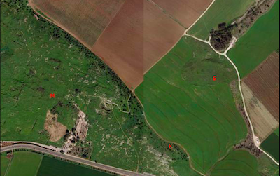
the Spring of Jezreel (trees at top
right of photo). Jezreel Expedition
photo.
Area S is located in the uncultivated land – masha – located directly south of and above the spring (Figure 2). In order to understand the occupation sequence of this area, the 2014 excavation squares were partly extended and three new 5x5 meter squares were opened a few meters further south in sub-area Area Sc under the supervision of Dr. Julye Bidmead (Chapman University) and Michael Koletsos of (University of Michigan).
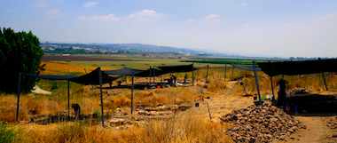
background. View east. The Spring of Jezreel is in
the trees in left of photo. Jezreel Expedition photo.
To the east of this area and on the other side of the ancient path excavated in 2014, seven 5x5 meter squares were opened in sub-area Area Sd under the supervision of Ian Cipin (University of Haifa) and Noga Blockman (Tel Aviv University) (Figure 3).
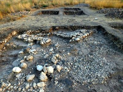
comprised of the three
squares (top of photo)
south of the 2014
excavation area (bottom of
photo). View south.
Jezreel Expedition photo.
Excavations in Area Sc (Figure 4) revealed a layer of stones immediately below the surface made up of small limestone boulders and many broken basalt grinding stones and other artifacts that was up to one meter thick in places. Although the broken basalt grinding stones were similar to those deposited in the intentionally-laid stone mantle excavated further east during the
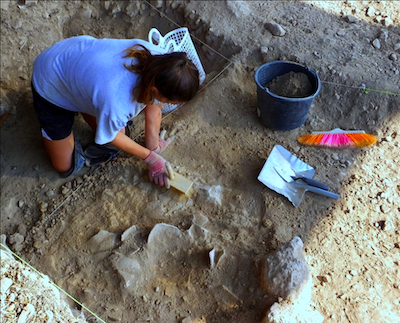
restorable Early Bronze
Age vessels in Area Sc.
Jezreel Expedition photo.
2013 season, the Area Sc material was contained in mixed debris that included Iron Age, Roman, and Roman/Byzantine period pottery. We believe that this mixed debris was deposited by later inhabitants in order to either clear the area of the site located directly upslope (as-yet unexcavated) or create a level area for some unknown purpose. Architectural features, including a wall stub and an installation containing restorable Early Bronze Age vessels (Figure 5), were identified directly below the layer of rocky debris. Bedrock was reached in the northeast quadrant of the northernmost of the three squares testifying that this area, unlike the eastern part of Tel ‘Ein Jezreel, was not inhabited prior to the Early Bronze Age. The Early Bronze Age installation and the revealed bedrock, together with information gleaned from the limited extension of the 2014 excavation squares, shed light on the nature of Early Bronze Age occupation on the western part of the site, and the interesting Iron Age and imported Roman pottery contained in the debris signify that remains from these periods are probably located nearby.
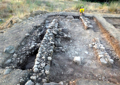
building in Area Sd. View north.
Jezreel Expedition photo.
Excavations in Area Sd revealed a large building just under the surface in the two westernmost squares located close to the edge of a promontory above the ancient path excavated in 2014 that leads down to the spring (Figure 6). This broadroom structure was constructed directly on top of the basalt flow and incorporated this basalt ‘bedrock’ in its foundations. Although the pottery was mixed, our initial evaluation is that this building dates to the
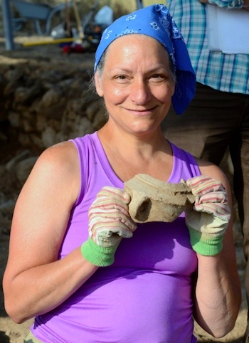
Age pottery excavated in
Area Sd. Jezreel
Expedition photo.
Roman/Byzantine period with some evidence of reuse in the Crusader period. Trapped in a bedrock crevice below the building’s north wall was a partially restorable Iron Age vessel that suggests activity or occupation in this area during this period (Figure 7).
Jezreel Expedition photo.
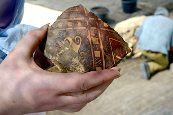
Three squares opened to the east of the building were excavated quickly down to basalt ‘bedrock’ and no architecture was revealed. The basalt ‘bedrock’ was cut into in one of the squares, leaving a
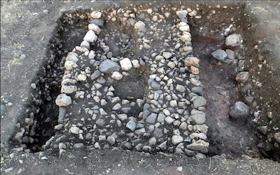
dating to the Bronze or Iron
Age. View east. Jezreel
Expedition photo.
quantity of lime material; we initially thought this was a lime kiln, but now believe that lime was being quarried from beneath the basalt flow in this area. Large sherds of beautifully-decorated medieval pottery were recovered from this installation (Figure 8). Two more squares were opened to the southeast of the building. A well-built wall approximately three meters thick was exposed running east-west in one of the squares; its date is still unknown but it is likely from the Bronze or Iron Age (Figure 9). The adjacent and southernmost square was excavated down to bedrock in its northwest quadrant and revealed interesting geological features that deserve further investigation.
In addition to our main excavation areas Sc and Sd, three one-meter-wide trenches, Areas Sa and Sb, were opened between the masha and the agricultural field to the south that separates the lower Tel ‘Ein Jezreel from the northern slope of Tel Jezreel.
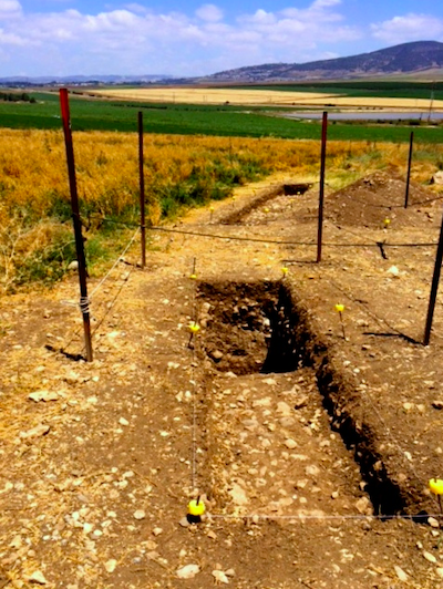
Sa2. View southeast. Jezreel
Expedition photo.
Area Sa, supervised by Dr. Deborah Appler (Moravian Theological Seminary), consisted of two trenches; one trench exposed a section of the path that connected Tel Jezreel and the spring (Figure 10). During the last few days of the season, Dr. Appler also excavated a section of this path in the area immediately west of the building revealed in Area Sd. The exposure of these two sections of path adds to information gleaned in 2014, when a number of sections of the path were excavated across the site. The second trench in Area Sa reached a depth of two meters with no sign of occupation.
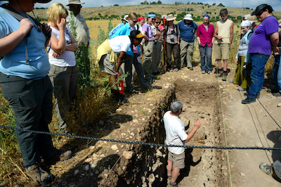
Expedition photo.
Area Sb, supervised by Dr. Philippe Guillaume (Universität Bern), was located east of Area Sa and south of our 2013 excavation area. One meter-wide trench (Figure 11) yielded a large quantity of pottery especially in the lower levels, and the presence of large Early Bronze Age sherds at a depth of nearly two meters suggests that the site extended at least this far south during the early periods.
Work was continued in Area K as well. Area K is the location of the large rock-cut winery excavated during the 2013 season (http://www.bibleinterp.arizona.edu/articles/2013/08/fra378012) and a Middle Bronze Age burial cave cut into the northern slope of Tel Jezreel and excavated during the 2014 season. Under the supervision of Dr. Guillaume, the Middle Bronze Age burial cave was reevaluated and excavated completely and the rock face above was examined for evidence of other tombs. Very poorly-preserved human and animal bone fragments were the only finds from the badly damaged cave in 2015.
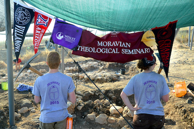
consortium member institutions.
Jezreel Expedition photo.
The Jezreel Expedition benefits from the generosity of a number of individuals and organizations. In addition to support from the six members of the Jezreel Consortium (Figure 12) and several anonymous donors, the project received support from the following in 2015: The Foundation for Biblical Archaeology, Anchor Industries, Inc., Home Depot, and the Jezreel Valley Winery. The Jezreel Expedition is an American Schools of Oriental Research Affiliated Field Project and a Register of Professional Archaeologists Certified Archaeological Field School. We are most grateful to the members of Kibbutz Yizre’el for their assistance with many aspects of the expedition, genuine enthusiasm for the project, and truly exceptional hospitality.
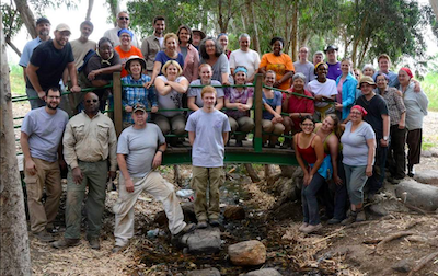
team at the end of the second
week. Jezreel Expedition photo.
All are welcome to participate in the 2016 season at Jezreel May 27-June 24; please see www.jezreel-expedition.com or find us on Facebook for more information (Figure 13).
Comments (1)
Congrats.
#1 - Gloria London - 09/18/2015 - 21:30
